
Last verified: October 2, 2026. I re-check the guide rule, the Bureau des Guides prices and the rebuilding figures against published sources. Guide, mule and refuge day rates have no public tariff, so those are quotes I collect in Imlil. Euro prices convert at Bank Al-Maghrib’s daily fixing.
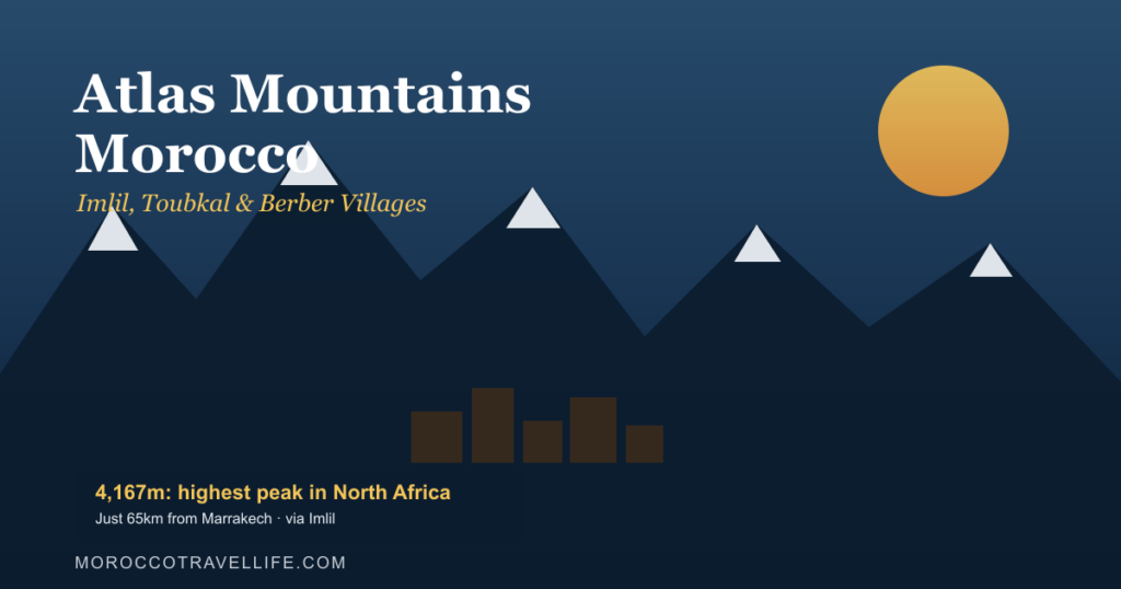
If you want to see the Atlas Mountains, Morocco makes it easy: the range starts about an hour south of Marrakech. Mount Toubkal, North Africa’s highest peak, tops out at 4,167 m (Wikipedia, 2026). Imlil, the village nearly every trek starts from, is 64.7 km from Jemaa el-Fna by road (OpenStreetMap routing, measured October 2026).
Disclosure: Some links in this guide may earn us a commission, at no extra cost to you. It never changes what we recommend.
I head up to Imlil on most of my trips through Marrakech. Sometimes it’s for a day hike. Sometimes it’s just for cooler air when the city bakes in August. This guide covers getting there, the guide rule, real costs, the villages worth a walk and how the 2023 earthquake changed the valley. For the wider picture of Morocco’s regions, start with my Morocco city and region guide.
Key Takeaways
- Toubkal reaches 4,167 m, and the standard route from Imlil takes 2 days with a night at the 3,207 m refuges (Wikipedia, 2026).
- Since December 2018, trekkers must hire a guide and check in at four security posts on the route (Yabiladi, 2018).
- Imlil’s Bureau des Guides sells a 2-day Toubkal ascent from €190, about 2,090 MAD, with Marrakech transport included.
- The 2023 earthquake destroyed or badly damaged Imlil; by March 2026 over 54,400 homes across the zone were rebuilt or repaired.
Table of Contents
How Do You Get from Marrakech to Imlil?
Imlil is 64.7 km from Jemaa el-Fna by road, about 80 minutes of free-flowing driving through Asni (OpenStreetMap routing, measured October 2026). Budget closer to 90 minutes with traffic and a slow final climb. Shared taxis and minibuses connect Imlil with Asni, the nearest town (Wikipedia, 2026).
Three options work in practice:
- Shared grand taxi in two hops: Marrakech to Asni (48.9 km), then a second taxi up the last 15.9 km to Imlil. Cheapest, slowest, and you agree the fare before you get in.
- Private taxi or driver: door to door, and the only easy way to start before dawn. Split it across a group.
- A trek package with transfer: the Bureau des Guides bundles the round trip from Marrakech into its Toubkal packages (Bureau des Guides Imlil, 2026).
Driving yourself is fine on a dry day. The road is paved the whole way, but it narrows and twists after Asni. My guide to renting a car in Morocco covers documents and road rules. For taxis, buses and trains in general, see how to get around Morocco.
Is Imlil Worth a Night Even If You Don’t Climb Toubkal?
Yes. Imlil sits at about 1,740 m, and it exists largely because of the mountain: about 90% of its visitors head up toward Toubkal (Wikipedia, 2026). That leaves the village itself quiet. Once the day-trippers leave for Marrakech in the late afternoon, the valley goes still.
The village is small and built around trekking. You’ll find gear shops, gites, mule yards and a few cafés with terrace views. It sits at the end of the tarmac, which is why guides and mules are hired here (Wikipedia, 2026). It also sits inside Toubkal National Park, created in 1942 and covering 380 km² (Wikipedia, 2026).
My advice is simple. Give Imlil, Morocco’s best-known trailhead, one night on its own terms, before or after any trek. A day trip shows you the road. A night shows you the place. If a day is all you have, my day trips from Marrakech ranking explains what fits into one.
How Hard Is the Toubkal Hike?
The Toubkal hike is non-technical in summer, but it’s a real mountain day. You climb from Imlil at about 1,740 m to the refuges at 3,207 m, then 960 m more to the 4,167 m summit (Wikipedia, 2026). Wikipedia describes the standard ascent as two days with a refuge night, needing good fitness for the altitude.
The Standard 2-Day Route
Day one walks up the Mizane valley. You pass Aroumd at 1,900 m (Wikipedia, 2026), then the shrine hamlet of Sidi Chamharouch. From there the trail climbs steeply to the two stone refuges, Refuge du Toubkal and Les Mouflons. Plan on about seven hours.
Day two starts in the dark. The summit is about four hours up, then roughly three back to the refuge. After that comes the long walk down to Imlil, up to five hours more (Wikipedia, 2026). That makes the descent the part of a Toubkal hike people underestimate. It’s a 2,400 m drop on tired legs.
Altitude Sickness on the Toubkal Hike
Altitude, not distance, is what turns most people around. The CDC says acute mountain sickness affects about 25% of visitors sleeping above 2,450 m in Colorado, its benchmark example (CDC Yellow Book, 2025). The refuges sit at 3,207 m. On the 2-day route you sleep there the very first night.
A headache and short breath above the refuge are normal. Nausea, confusion or a headache that rest doesn’t fix mean you go down. Want a gentler profile? The 3-day variant through the Azzaden valley acclimatizes better, and my Mount Toubkal hike guide lays out both itineraries day by day.
Do You Need a Guide for Toubkal?
Yes, for any Toubkal hike. After two hikers were murdered near Imlil in December 2018, local authorities ruled that tourists must hire a guide or go with experienced locals (Yabiladi, 2018). Trekkers check in at four posts: Aroumd, Sidi Chamharouch, Agdal and the refuge. I’ve found no report of the rule being lifted.
Book through Imlil’s Bureau des Guides, which calls itself Morocco’s first mountain guides association. Its guides train at the CFAMM in Tabant or in Briançon, France, and work under Law 05-12 on tourist guides (Bureau des Guides Imlil, 2026). Ask any guide offered on the street for their professional card. A real one won’t mind.
The rule also matches the real risk. Most trouble up here isn’t dramatic. It’s a mule track mistaken for the main trail, or a push past the refuge as the weather turns. A guide’s real value is the person who calls the day off.
What Does a Toubkal Trek Cost?
A 2-day Toubkal ascent from Imlil’s Bureau des Guides starts at €190, about 2,090 MAD at Bank Al-Maghrib’s October 1 fixing of 11.0017 MAD. That price covers transport from Marrakech, a guide, a mule, a cook and all trek food (Bureau des Guides Imlil, 2026). Drinks and tips are extra.
Booking the pieces yourself in Imlil, Morocco, costs less, especially in a group. These are the day rates quoted to me in Imlil in 2026. No body publishes an official tariff, so treat them as a guide and confirm on arrival.
| Item | Rate quoted in Imlil, 2026 | Notes |
|---|---|---|
| Licensed mountain guide | 400-450 MAD/day | Per group, so split it |
| Mule + muleteer | 220-280 MAD/day | Carries bags; you still walk |
| Refuge dorm bed only | 150-180 MAD/night | Shared bunk room |
| Refuge half-board | 380-450 MAD/night, per person | Bed, dinner and breakfast |
| Imlil gite half-board | 250-350 MAD/night, per person | Warmer and more comfortable |
Here’s the math for the 2-day route. A group of three splits two guide days and two mule days, then pays its own refuge half-board. That lands at about 790-940 MAD each. Add the taxi and tips, and it’s the 900-1,100 MAD range my Toubkal guide quotes. A solo trekker carries the guide and mule alone, so the same trip runs about 1,620-1,910 MAD.
Want the 3-day route instead? The bureau’s 3-day Toubkal climb starts at €270, about 2,970 MAD, and its Imlil valley day trip at €70, about 770 MAD (Bureau des Guides Imlil, 2026). I convert euros at the daily fixing and round to the nearest 10 MAD, the same way as in my Morocco currency guide.
Which Berber Villages Near Imlil Are Worth the Walk?
The valleys around Imlil are Amazigh (Berber) country. Nationally, 24.8% of Moroccans use an Amazigh language in daily life, and the share is 33.3% in rural areas, per the 2024 census (HCP via Hespress, 2024). In these villages, Tachelhit is what you’ll hear first.
- Aroumd: the terraced village across the valley at 1,900 m (Wikipedia, 2026). It’s 1.6 km from Imlil on foot, about half an hour uphill, and it’s also the first checkpoint on the Toubkal trail.
- Tacheddirt: one of the highest villages in the area at 2,314 m (Wikipedia, 2026). It’s about 13.7 km from Imlil by trail on OpenStreetMap routing, so it’s a full day or an overnight.
- Ait Souka: a small hamlet just above Imlil. It’s the short option when you have an hour and want a view down the valley.
- Asni’s Saturday souk: Imlil has no market of its own. Asni, the nearest town, holds the weekly one on Saturdays (Wikipedia, 2026), so it’s easy to catch on the drive up.
For the language, music and customs behind these villages, see my Amazigh culture guide. If you’d like to share a meal in a family home, my Berber family visit guide explains how to find one that pays the family fairly.
How Did the 2023 Earthquake Change Imlil?
The magnitude 6.8 earthquake of September 8, 2023 struck Al Haouz province, the same province as Imlil (USGS, 2023). It killed 2,946 people, according to the Interior Ministry (Hespress, 2023). Imlil and the villages around Toubkal were destroyed or severely damaged (Wikipedia, 2026).
The trails came back first. By September 23, local mountain guides were already out clearing the paths up Toubkal so visitors could return (Hespress, 2023). Housing took longer. By September 2025, Al Haouz province had reached 91.33% completion, with nearly 24,000 homes rebuilt or rehabilitated (maroc.ma, 2025).
Across the whole quake zone, more than 54,400 homes had been completed or rehabilitated by 2026. The state had paid over 7.2 billion dirhams to families (LeBrief, 2026). Several thousand sites were still under way. So expect new concrete beside old stone, and a few lanes still under scaffolding.
Does that mean you should stay away? No. Tourism money is part of the recovery, and the guides, muleteers and gite owners depend on it. Just don’t treat damaged houses as a photo stop. Ask your guide what a village went through before you walk in with a camera.
When Is the Best Time to Trek in the Atlas Mountains?
April-May and September-October are the best months for a Toubkal hike. Oukaïmeden, a ski station near Toubkal, averages 47.5 snowy days a year. Almost all of them fall between November and April (Wikipedia, citing the Association Internationale de Climatologie, 1982-1994 data).
Even there, the ski area is only at 2,600 to 3,200 m (Wikipedia, 2026). Its January nights average -3.3°C. The summit is nearly 1,000 m higher, so winter up top is colder still. In winter the mountains are covered in snow and ice and can be prone to avalanches (Wikipedia, 2026). That means crampons, an ice axe and a guide who has done it in snow.
| Season | Trail conditions | Who it suits |
|---|---|---|
| April-May | Snow clearing from the upper trail, green valleys | First-timers; the best all-round window |
| June-August | Dry, hot in the lower valley, cool at the refuges | Anyone fleeing Marrakech heat; start early |
| September-October | Stable and snow-free on the standard route | The second-best window, with fewer groups |
| November-March | Snow and ice above the refuges | Experienced winter hikers only |
Summer in Imlil is the cool escape. Wikipedia notes that the mountains can be very dry in summer, with the odd storm. For the month-by-month view across the whole country, see my best time to visit Morocco guide.
Where Else in the Atlas Mountains Should You Go?
Imlil is the famous door, not the only one. Oukaïmeden lies about 80 km south-southeast of Marrakech, with six ski lifts between 2,600 and 3,200 m (Wikipedia, 2026). It’s a winter ski day and a summer bouldering spot. Other valleys suit other trips.
- Ourika Valley: the easy half-day, with riverside cafés and short waterfall walks. My day trips guide covers how far up to go.
- Aït Bouguemez: the “Happy Valley” of the Central High Atlas, in Azilal province (Wikipedia, 2026). It’s a long drive, but it’s home to Tabant’s mountain-guide school.
- A kasbah or eco-lodge base: stone kasbahs near Imlil make the trek feel less like a commute. My Atlas kasbah guide and eco-lodges guide compare them.
Atlas Mountains Morocco Packing List
Pack for a mountain, not for Marrakech. Freezing conditions are possible above 3,500 m even outside winter (Wikipedia, 2026), and the summit morning of a Toubkal hike starts in the dark. A warm layer belongs in your bag in every month. Here’s what makes the difference:
- Broken-in hiking boots with ankle support, not trainers
- A fleece or light down jacket, even in July
- A headlamp for the pre-dawn summit start
- Trekking poles for the long descent
- Sunscreen, a hat and sunglasses, because UV is stronger up high
- A soft duffel for the mule, never a rigid suitcase
- A small first-aid kit, plus cash in small notes for tips
For everything else, from medina dress to desert nights, use my what to pack for Morocco guide. For safety beyond the mountains, my is Morocco safe guide separates real risks from myths.
Frequently Asked Questions
Do I need a guide to climb Mount Toubkal?
Yes. Since December 2018, local authorities in Imlil have required trekkers to hire a guide or go with experienced locals. You also check in at four security posts on the route. Book through Imlil’s Bureau des Guides, and ask any guide offered to you for their professional card.
How many days does the Toubkal hike take?
Two days is standard. Day one is about seven hours from Imlil to the refuges at 3,207 m. Day two is a pre-dawn push to the 4,167 m summit and the long walk back down. A 3-day route through the Azzaden valley acclimatizes better for anyone new to altitude.
Is Imlil worth visiting without climbing Toubkal?
Yes. Imlil sits at about 1,740 m, only 64.7 km from Jemaa el-Fna, with cooler air and easy walks to villages like Aroumd. Stay one night if you can. The valley is at its best in the evening, after the day-trippers have gone back to Marrakech.
What’s the best month to trek the Atlas Mountains?
April-May and September-October. At Oukaïmeden, near Toubkal, almost all of the 47.5 snowy days a year fall between November and April. Winter treks need crampons, an ice axe and a guide with snow experience. Summer works too if you start early to beat the valley heat.
How much does a Toubkal trek cost?
The Bureau des Guides sells a 2-day ascent from €190, about 2,090 MAD, with Marrakech transport, guide, mule and food included. Booking the pieces in Imlil, a group of three pays about 790-940 MAD each before taxi and tips. A solo trekker pays about 1,620-1,910 MAD.
Is it OK to visit Imlil after the 2023 earthquake?
Yes. Guides were clearing the Toubkal paths within weeks, and by September 2025 Al Haouz province was 91.33% through its housing rebuild. Visitor spending supports guides, muleteers and gite owners. Expect some construction, and ask before photographing damaged homes or people.
Is the Atlas Mountains Trip Worth It?
Yes, if you give it a night. Toubkal is North Africa’s highest summit, and its trailhead is only 64.7 km from the Marrakech medina. Imlil, Morocco’s main trekking village, rewards a slow evening as much as a summit. Hire a licensed guide, budget honestly for the mule and refuge, and add a buffer day if you can.
If you’re planning the Atlas Mountains, Morocco has plenty more to fit around it. Head back to my Morocco city and region guide to build the rest of the route.